Material
Engraving
About
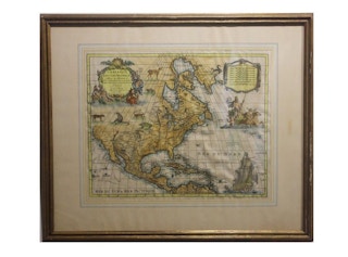
Copperplate engraving hand colored map of Northern America. The figures of the mythical figure along the right side and the animals were added in later after the original printing. The publisher was Chez Pierre Mortier and the Creator was Guillaume de I'Isle. The map is framed in a gold wooden frame.
Geographical Description
Map of North and Central America showing the northernmost part of South America. The entire northwest coast above California is black. Cartographic elements include lines of latitude and longitude, scales, sea banks, and routes of explorers on the west coast. Decorative cartouche includes Neptune and two river gods, trident, oar, and dolphin.
Historical Notes
Creator Guillaume de I'Isle was the first to show Califonia as a peninsula and the first to show the Saragossa Sea in his map of 1700. This map was re-engraved from that map. It has also been ascribed to Nicolas Sanson.
Dimensions
H 25 in. x W 29.5 in. x D 1 in.
